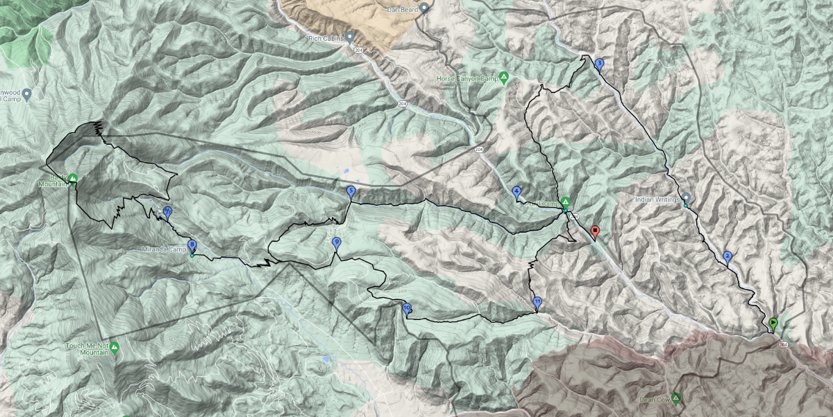
Day 1
Opening Campfire
Day 2
The adventure begins with a bus from Base Camp to the Six-Mile Trailhead.
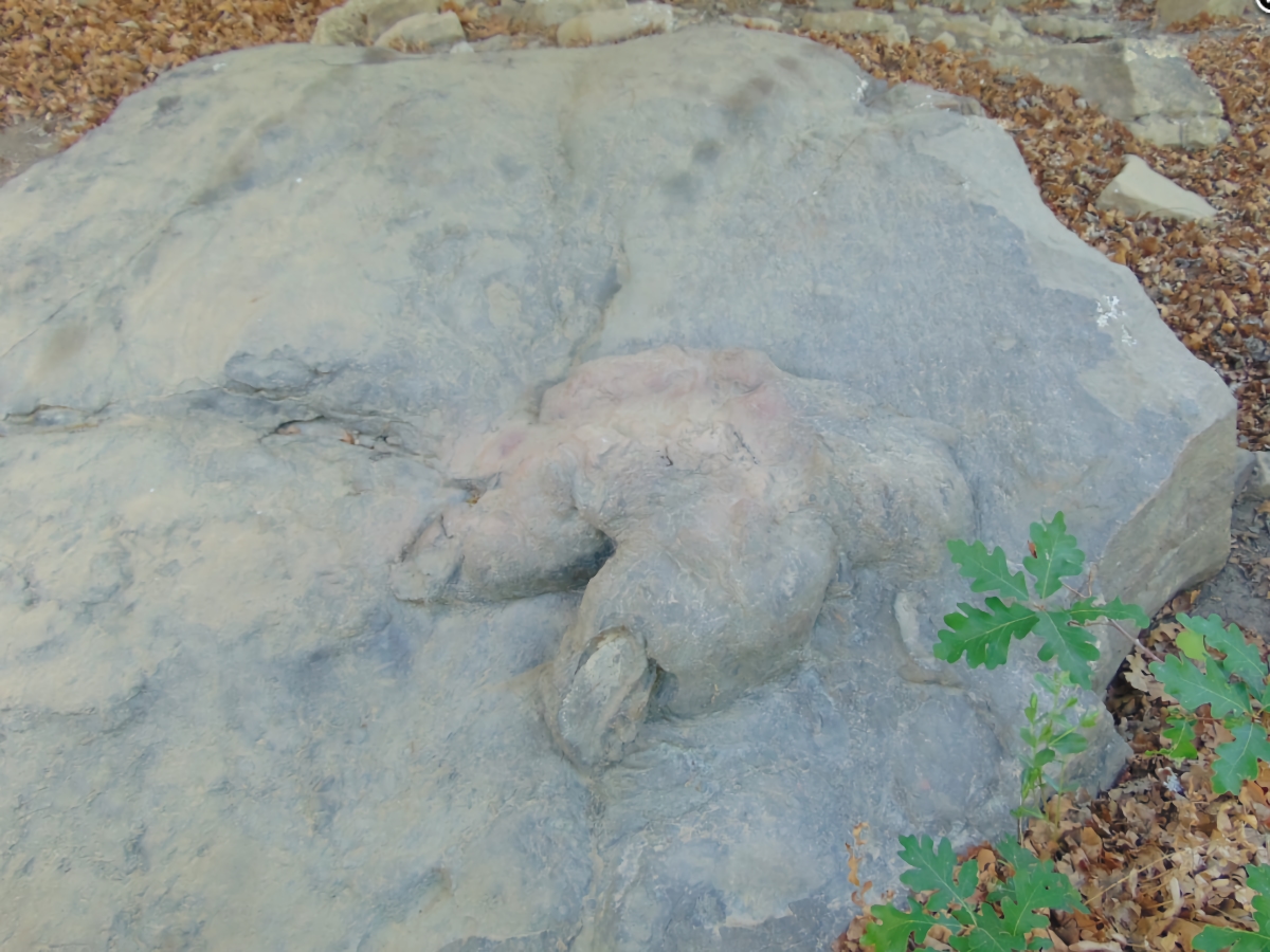
A short hike to the first confirmed T-Rex footprint in the world.
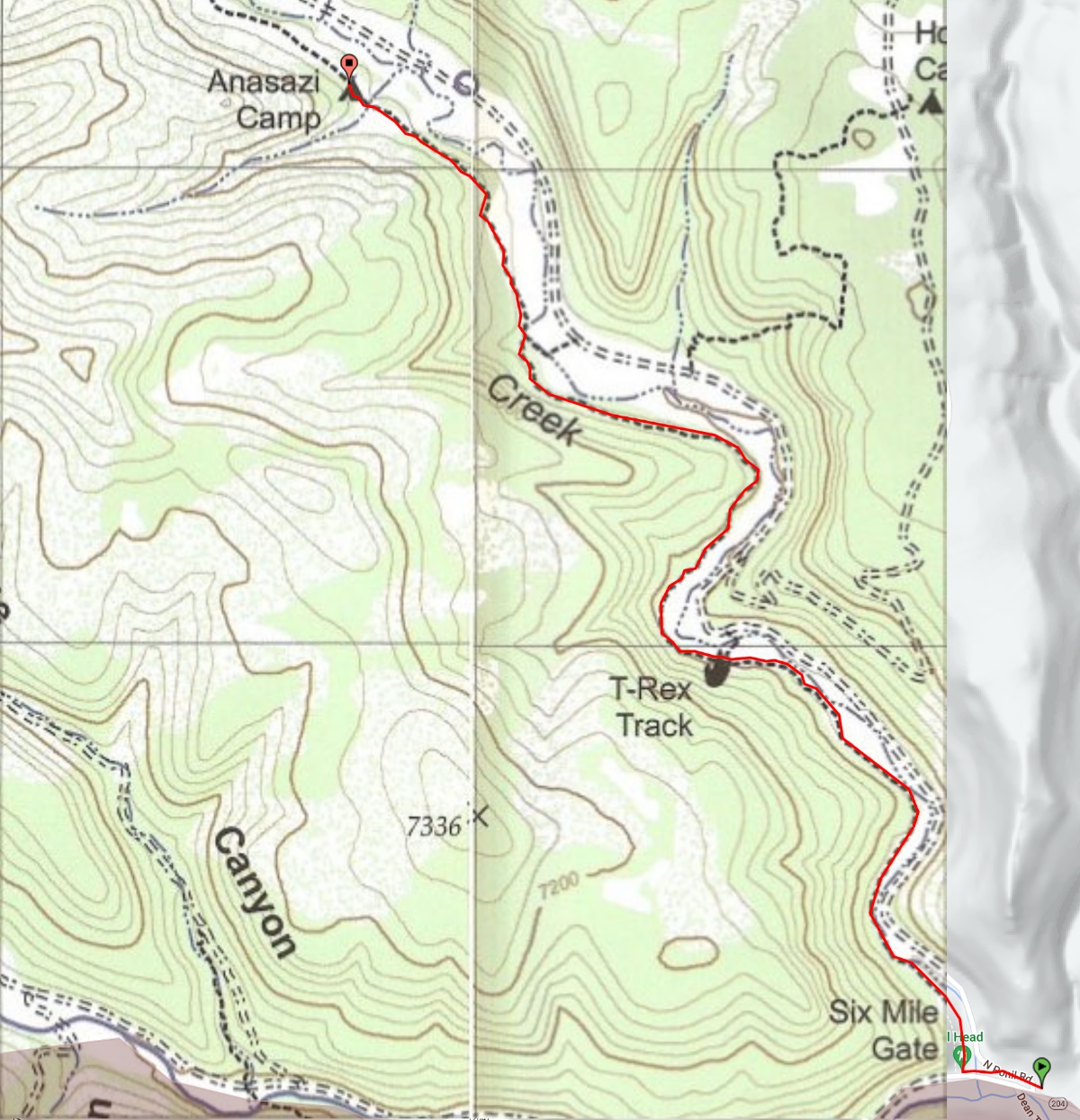
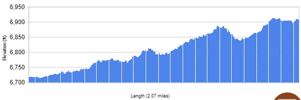
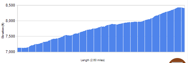
This trail segment goes between 6-Mile Gate Turnaround at an elevation of 6718 ft. and Anasazi at an elevation of 6909 ft. (+191 ft), covering 2.07 miles.
Make your way to Anasazi trail camp (trek overview marker 2) where your Ranger will pass on important skills.

Day 3
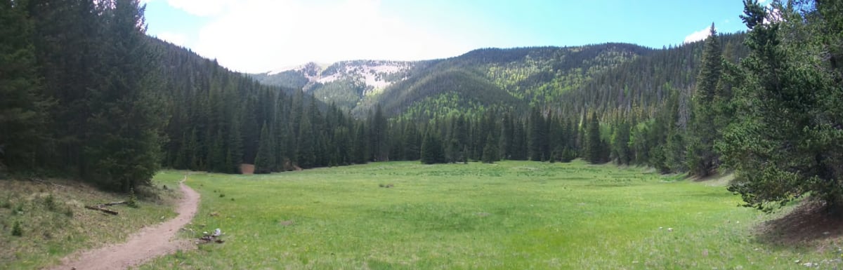
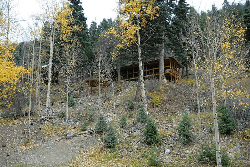
Head up the North Ponil Canyon to Indian Writings (Staffed Camp w/ Showers) where you will see ancestral Puebloan petroglyphs and archeology sites.
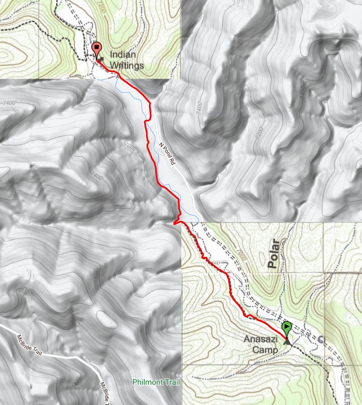
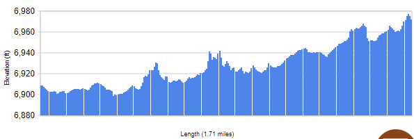
This trail segment goes between Anasazi at an elevation of 6909 ft. and Indian Writings at an elevation of 6972 ft. (+63 ft), covering 1.71 miles.
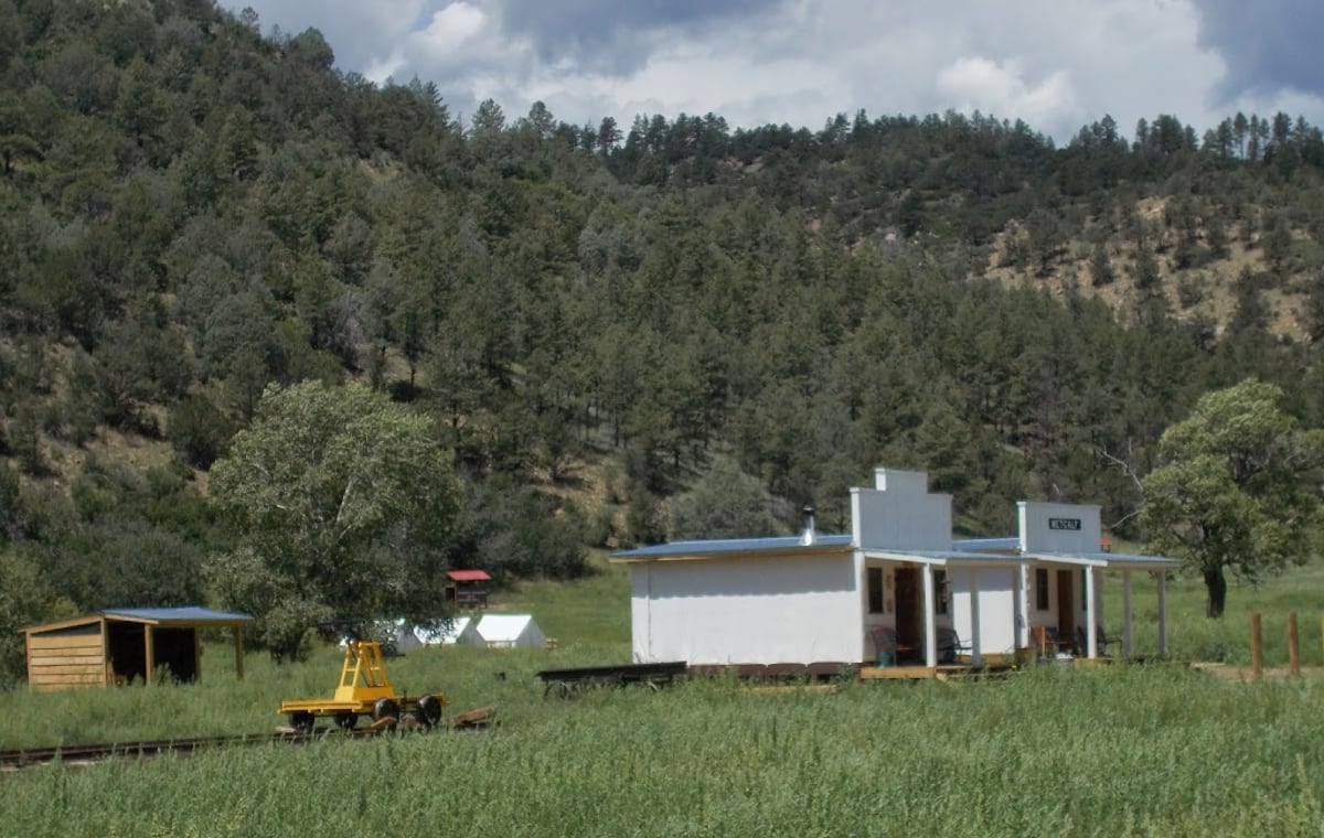
Listen for the echo of the mauls striking spikes as you make your way to Metcalf Station (marker 3) to learn what life was like on the railroad.
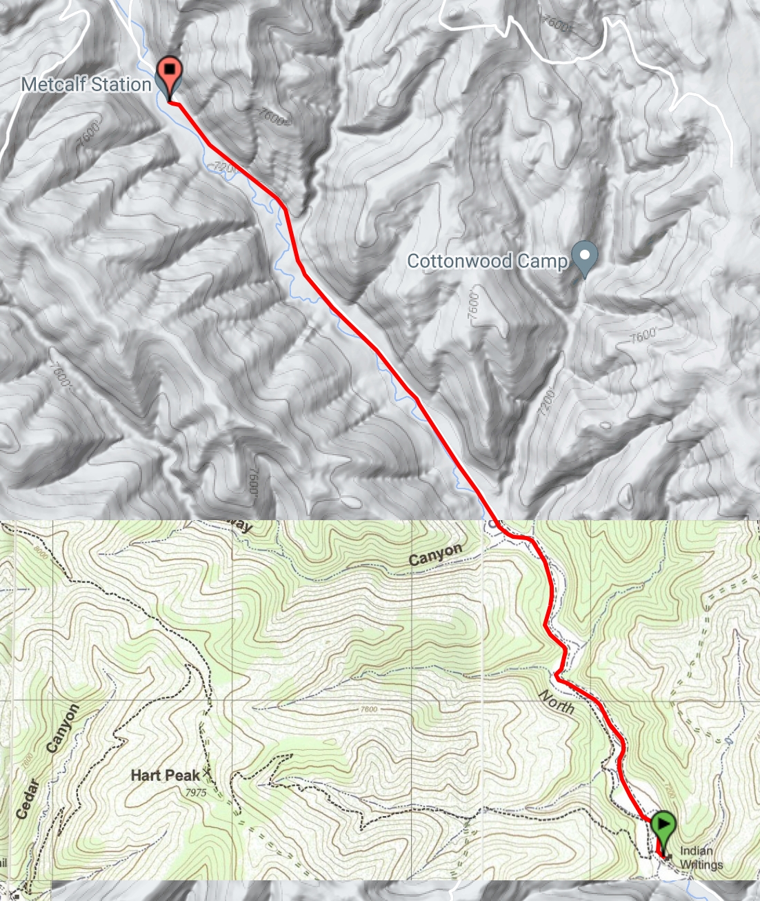
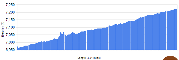
This trail segment goes between Indian Writings at an elevation of 6972 ft. and Metcalf Station at an elevation of 7222 ft. (+250 ft), covering 3.34 miles.
Day 4
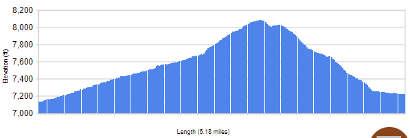
Help rebuild the railroad and enjoy great music and stories at the evening campfire.
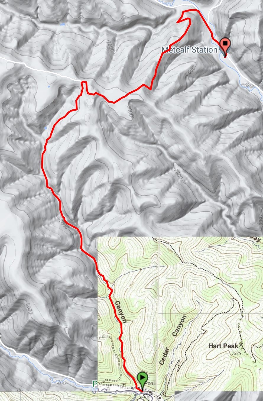
This trail segment goes between Metcalf Station at an elevation of 7222 ft. and Ponil at an elevation of 7133 ft. (+950 ft), covering 5.19 miles.
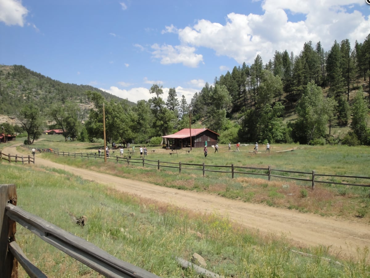
Ponil – Staffed camp with showers.
Day 5
Head to Sioux (marker 4 – Trail camp) and visit Ponil, where you will have the chance to do Cowboy Action Shooting, roping, and branding.
Reward yourself with a cold root beer at the cantina, chow down on a delicious chuckwagon meal and prepare to be entertained at the evening Cantina Show!
This trail segment goes between Ponil at an elevation of 7133 ft. and Sioux at an elevation of 7382 ft. (+249 ft), covering 1.07 miles.
You’ll be assigned your burro and learn how to care for it and pack it properly the next morning before you Head up the North Ponil River to the Continental Tie and Lumber Co. at Pueblano
DAY 6
Ponil – Flume Canyon (Trail Camp) – Pueblano (Staffed Camp)
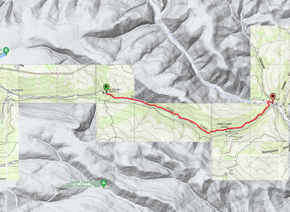
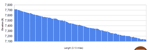
This trail segment goes between Ponil at an elevation of 7133 ft. and Flume Canyon at an elevation of 7717 ft. (+585 ft), covering 3.14 miles.

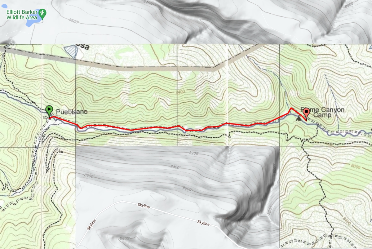
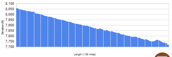
This trail segment goes between Flume Canyon at an elevation of 7717 ft. and Pueblano at an elevation of 8059 ft. (+342 ft), covering 1.7 miles.

At Pueblano where your crew can climb spar poles and make rail ties before enjoying yet another amazing campfire performance.
Day 7
Move on up to Ute Meadows (Trail Camp) for a layover and prepare yourself with rest and reflection before your ascent of Philmont’s highest peak.
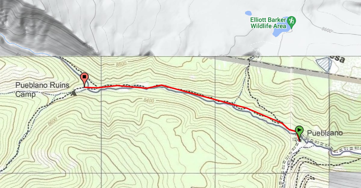
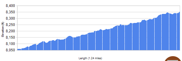
This trail segment goes between Pueblano at an elevation of 8059 ft. and Pueblano Ruins at an elevation of 8352 ft. (+293 ft), covering 1.25 miles.
Pueblano Ruins – Trail Camp
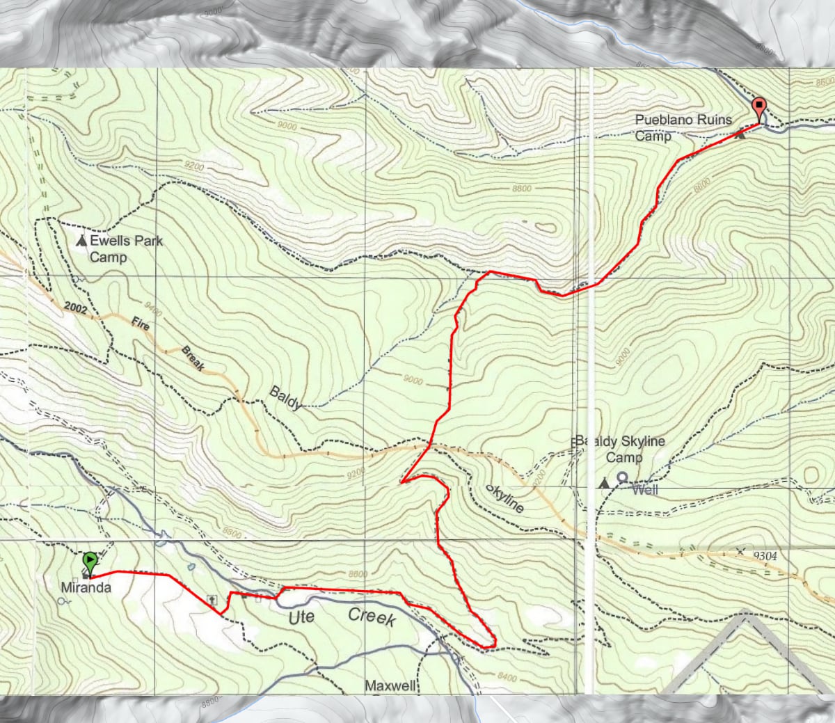
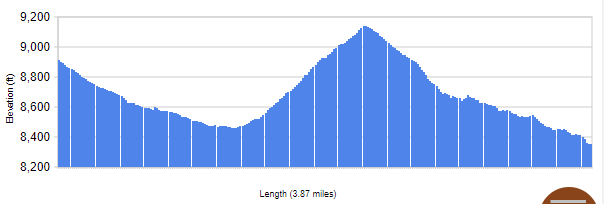
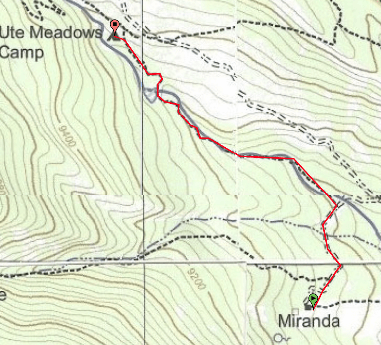
This trail segment goes between Pueblano Ruins at an elevation of 8352 ft. and Miranda at an elevation of 8914 ft. (+787 ft), covering 3.87 miles.
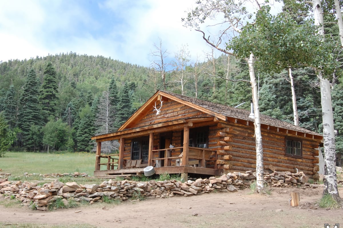
Mountain Man Rendezvous @ Miranda Trail Camp
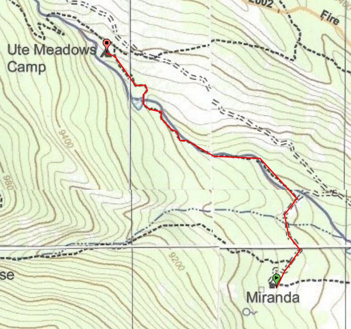
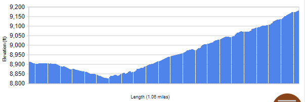
This trail segment goes between Miranda at an elevation of 8914 ft. and Ute Meadows at an elevation of 9181 ft. (+354 ft), covering 1.07 miles.
Black Powder Rifle, Burro Packing
Miranda – Staffed Camp, UTE Meadows – Trail Camp
Day 8
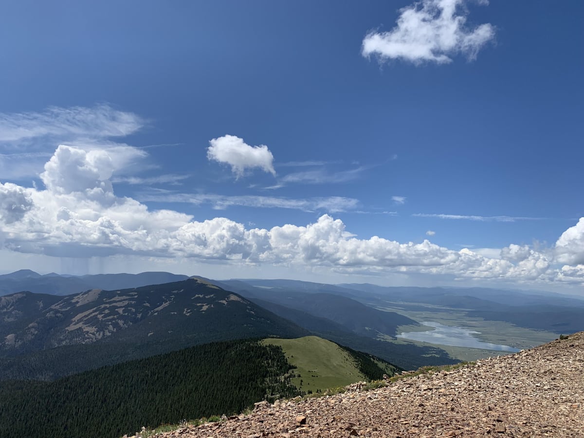
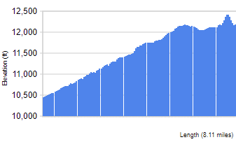
Climbing to the top of the 12,441 ft. Baldy Mountain is sure to be the highlight of your Philmont adventure!
Baldy Town – Staffed Camp with Showers
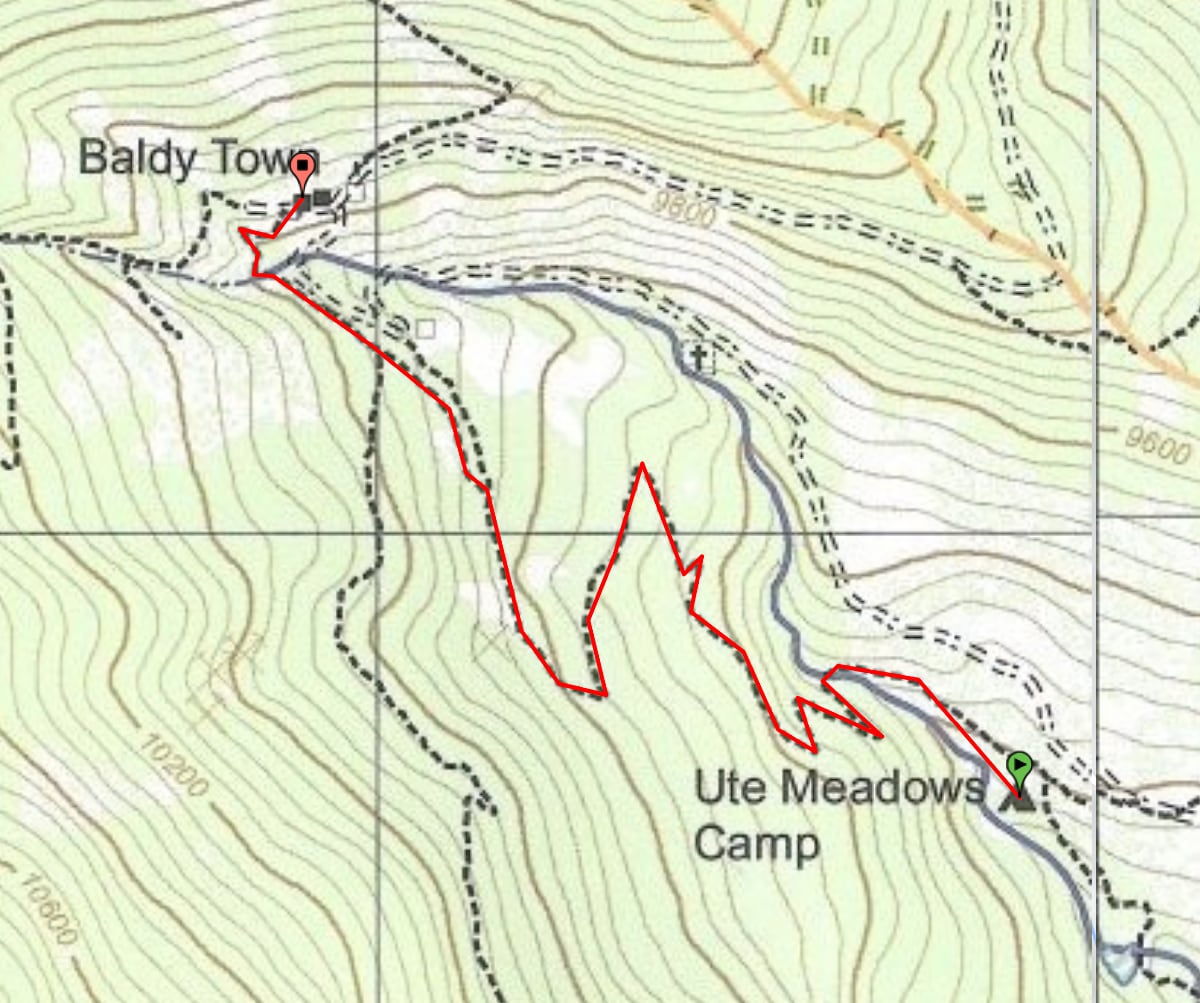
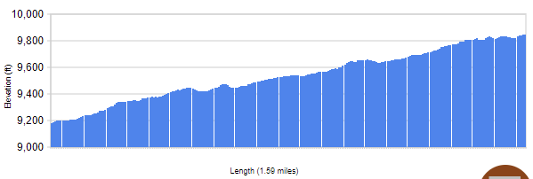
This trail segment goes between Ute Meadows at an elevation of 9181 ft. and Baldy Town at an elevation of 9844 ft. (+663), covering 1.6 miles.

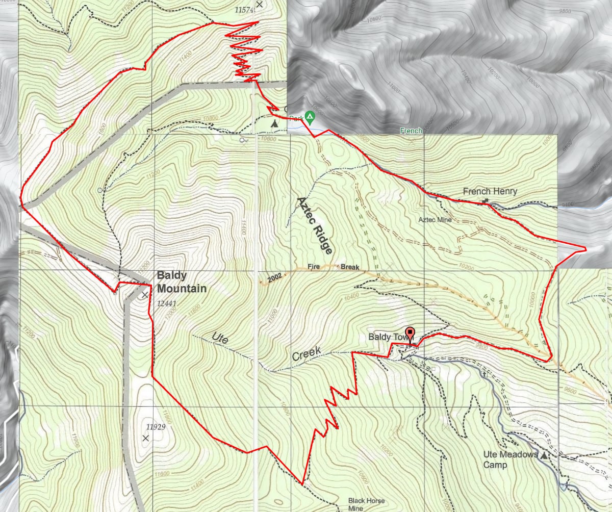
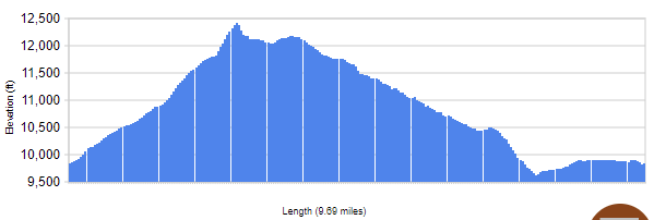
The Loop: This trail segment goes between Baldy Town at an elevation of 9844 ft. and Baldy Town at an elevation of 9844 ft., covering 9.7 miles.
This segment has a maximum elevation of 12423 ft. and a minimum elevation of 9623 ft., a range of 2800 ft.
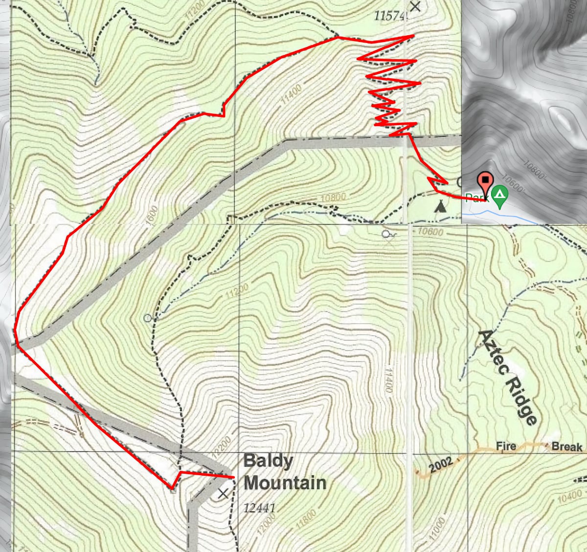
This trail segment goes between Baldy Mountain at an elevation of 12423 ft. and Copper Park at an elevation of 10452 ft. (-1970), covering 4.6 miles.
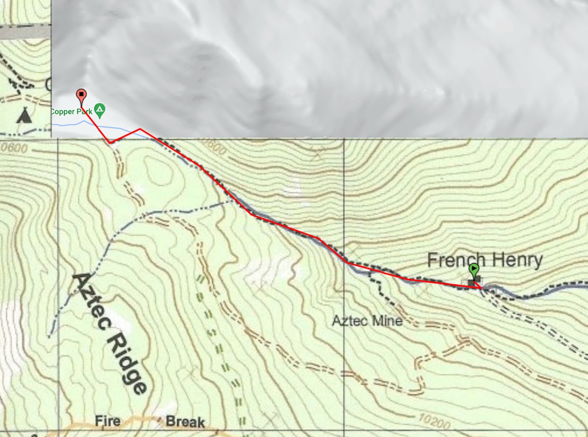
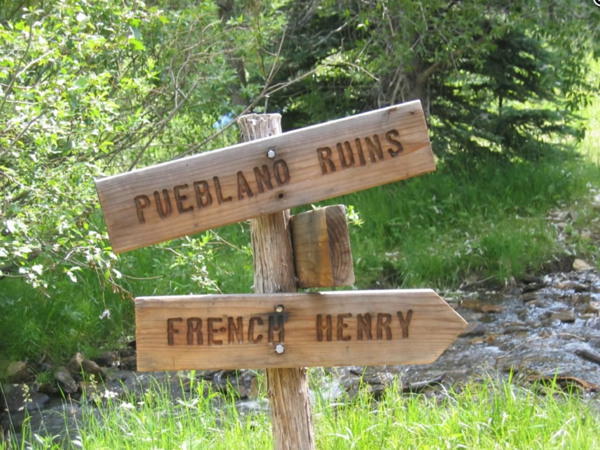
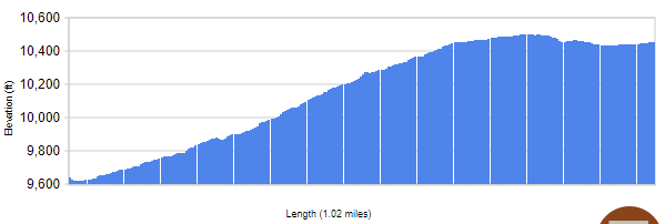
This trail segment goes between Copper Park at an elevation of 10452 ft. and French Henry at an elevation of 9637 ft. (-881 ft), covering 1.02 miles.
On to the Aztec Mine at French Henry
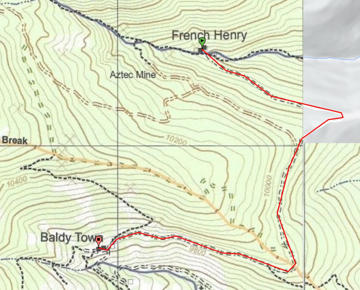
This trail segment goes between French Henry at an elevation of 9637 ft. and Baldy Town at an elevation of 9844 ft. (-294 ft), covering 1.85 miles.
This trail segment goes betweenBaldy Town at an elevation of 9844 ft. and Ute Meadows at an elevation of 9181 ft. (-663), covering 1.6 miles.
Copper Park – Trail Camp, French Henry – Staffed Camp, No Camping, Ute Meadows – Trail Camp.
Day 9
Conservation Project at Baldy Skyline Camp
Your next day is just a short hike to Miranda (Staffed Camp) where you will have plenty of time for muzzle loading rifles, tomahawks, and the mountain man rendezvous.
This trail segment goes between Ute Meadows at an elevation of 9181 ft. and Miranda at an elevation of 8914 ft. (-354 ft), covering 1.07 miles.


DAY 10
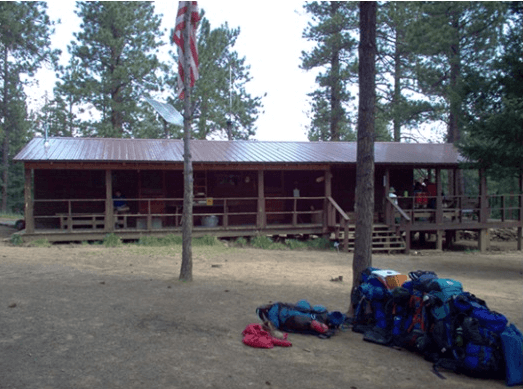
Challenge course events at Head of Dean (Staffed Camp) will help your crew build confidence and teamwork.
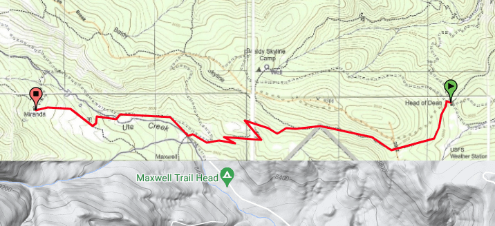
This trail segment goes between Miranda at an elevation of 8914 ft. and Head of Dean at an elevation of 8766 ft. (-599), covering 3.78 miles.
Day 11
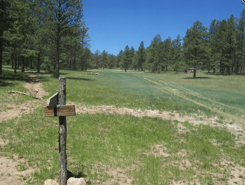
Shoot on over to Santa Claus (Trail Camp) camp where you will load your own shells before heading down to the range to shoot 12-gauge shotguns.
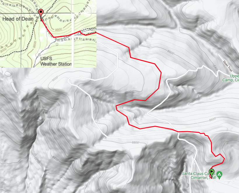
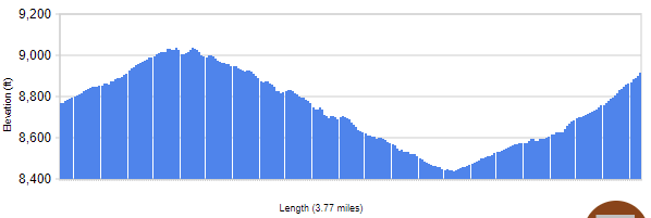
This trail segment goes between Head of Dean at an elevation of 8766 ft. and Santa Claus at an elevation of 8497 ft. (-271 ft), covering 3.14 miles.

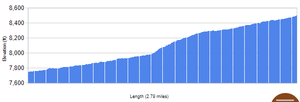
Day 12
Your final full day of hiking will take you to New Dean Trail camp
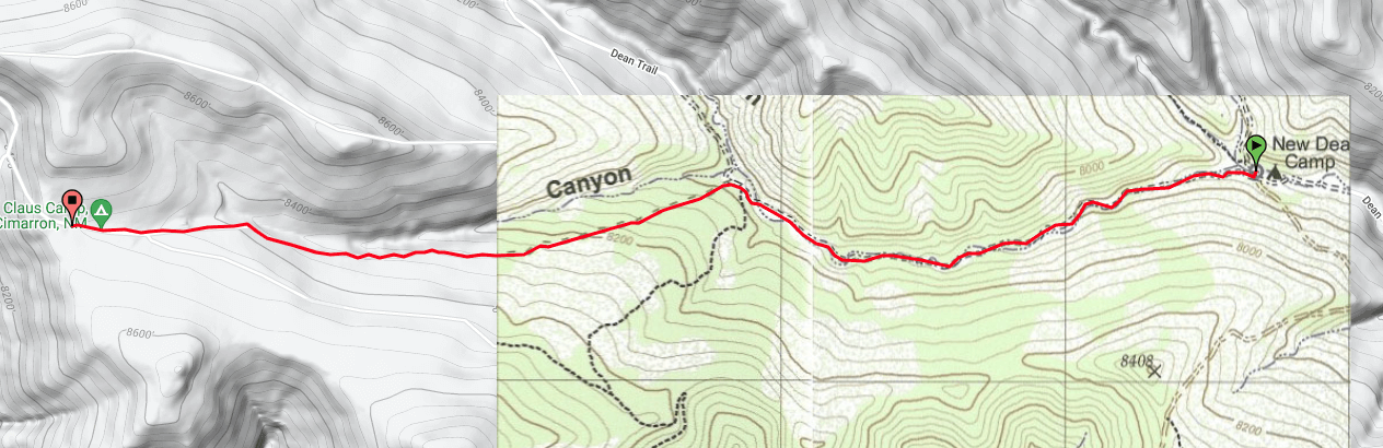
This trail segment goes between Santa Claus at an elevation of 8497 ft. and New Dean at an elevation of 7748 ft. (-749 ft), covering 2.8 miles.

Day 12
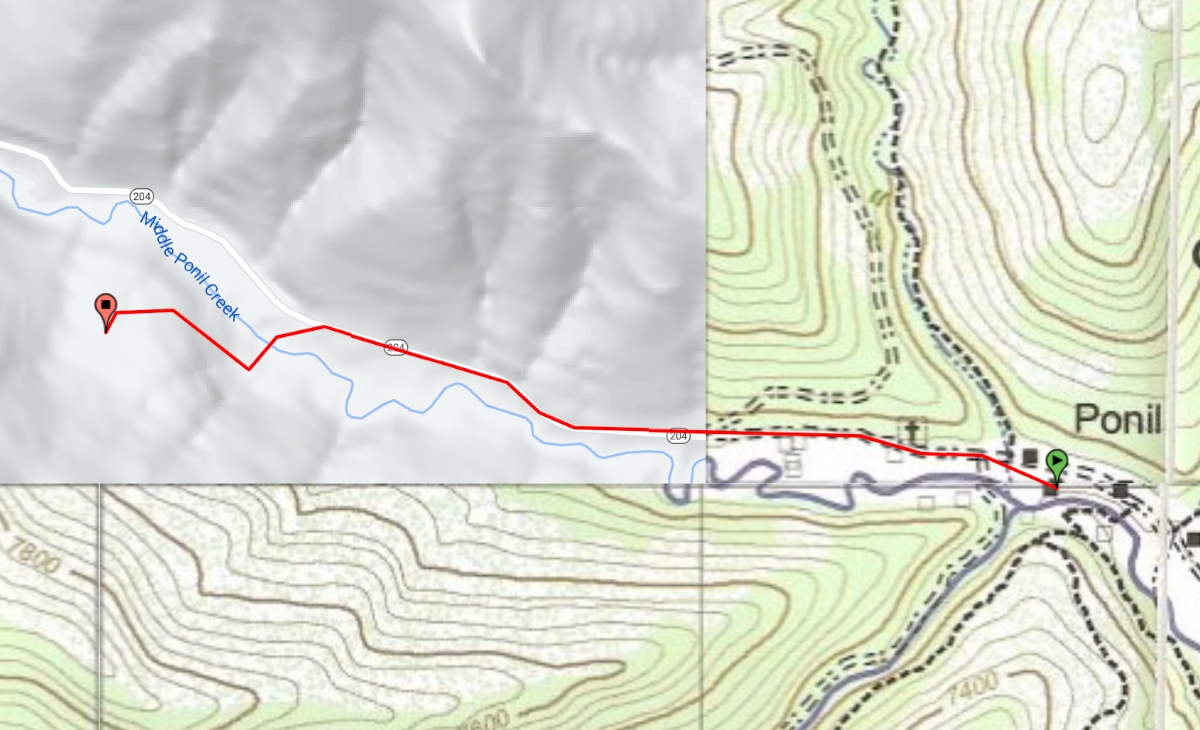
Head to the Ponil Trailhead for your trip back to Base Camp.
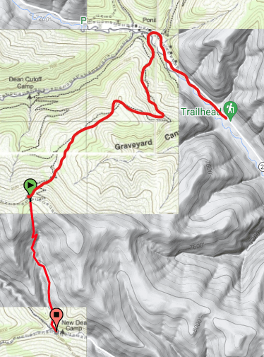
This trail segment goes between New Dean at an elevation of 7748 ft. and Dean Skyline at an elevation of 8412 ft. (+664 ft), covering 1.02 miles.
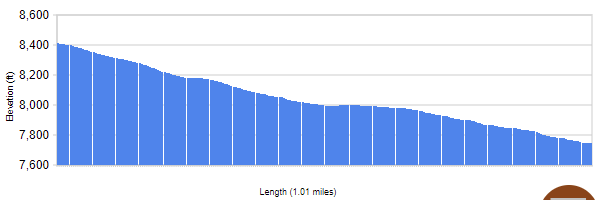
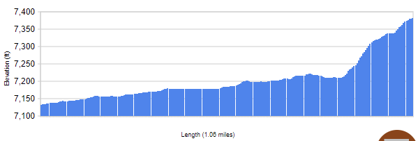
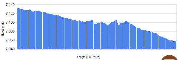
This trail segment goes between Dean Skyline at an elevation of 8412 ft. and Ponil at an elevation of 7133 ft. (-1306 ft), covering 2.61 miles.
This trail segment goes between Ponil at an elevation of 7133 ft. and Ponil Turnaround at an elevation of 7060 ft. (-75 ft), covering 0.9 miles.

| Day | Date | Camp | Miles | Elev. Rng. | Hdg. | Difficulty | Shower | Water | Food |
|---|---|---|---|---|---|---|---|---|---|
| Wed/29 | Arrive New Mexico | ||||||||
| 1 | Thu/30 | Camp HQ | |||||||
| 2 | Fri/1 | Anasazi Camp | 2.1 | 240 | 325 | Easy | No | Yes | |
| Indian Writings (Pass through) | (1.7) | 326 | Yes | ||||||
| 3 | Sat/2 | Metcalf Station | 5.0 | 450 | 327 | Easy | Yes | Yes | |
| Ponil (Pass through) | (5.2) | 1700 | ~240/~156 | Moderate | Yes | ||||
| 4 | Sun/3 | Sioux (Pass through) | (1.0) | 250 | ~275 | Easy | No | Yes | Yes |
| Ponil | 7.4 | -250 | ~95 | Easy | Yes | ||||
| Flume Canyon (Pass through) | (3.14) | 585 | Easy | Yes | |||||
| 5 | Mon/4 | Pueblano | 6.7 | 342 | Moderate | No | Yes | ||
| Miranda (Pass through) | (3.87) | 1,950 | Moderate | Yes | |||||
| 6 | Tue/5 | Ute Meadows | 7.1 | 442 | Moderate | No | Yes | ||
| Baldy Town (Pass through) | (1.6) | 663 | Easy | Yes | |||||
| Copper Park (Pass through) | (~11) | Yes | Yes | ||||||
| French Henry (Pass through) | (1.0) | Yes | |||||||
| 7 | Wed/6 | Ute Meadows | 13.4 (1.85) | 5600 | Hard | No | “ | ||
| 8 | Thu/7 | Miranda | 1.1 | 430 | Easy | No | Yes | Yes | |
| Conservation Project – Baldy Skyline (Pass through) | (3.0) | 1,124 | Moderate | Yes | |||||
| 9 | Fri/8 | Head of Dean | 5.3 (1.6) | -320 | Easy | No | Yes | ||
| 10 | Sat/9 | Santa Claus | 3.9 | 720 | Moderate | No | Yes | ||
| 11 | Sun/10 | New Dean | 2.7 | 749 | Moderate | No | Yes | ||
| Dean Skyline | (1.02) | 664 | Easy | ||||||
| Ponil (Pass through) | (2.61) | -1306 | Moderate | Yes | |||||
| Ponil Trailhead | (0.9) | -75 | Easy | ||||||
| 12 | Mon/11 | Camp HQ | 4.6 | ||||||
| Tue/12 | Return to Oviedo |